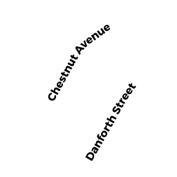
138 CHESTNUT AV
Owner Information
GUARNOTTA KEVIN
138 CHESTNUT AV
JAMAICA PLAIN, MA 02130


Property Details
138 CHESTNUT AV is classified as a Two-Family Residential (Conventional).
The primary structure on this property was built in 1905. There is 2,576ft2 of residential/living space within this property. This property is listed as having 10 rooms.
138 CHESTNUT AV is valued at $949,500. The land is valued at $287,200 and the structures are valued at $662,300.
The most recent deed for 138 CHESTNUT AV is recorded at the local registrar in Book 47824, Page 276. 138 CHESTNUT AV was last sold on Wednesday, April 20, 2011 for $9.
Assessment data from fiscal year 2020.
Flood Data
According to the FEMA National Flood Hazard Layer, this property does not appear to be in a flood zone. It may also be in an area not yet reviewed. Nonetheless, confirm this information prior to taking any action.
To view the flood hazards around this property, create a FEMA "Firmette" Map of the area around 138 CHESTNUT AV.
Broadband Internet Providers
| Provider | Type | Bandwidth (mbps) | |
|---|---|---|---|
| VSAT Systems, LLC. | Satellite | 2 | 1 |
| Crown Castle Fiber | Fiber | 0 | 0 |
| Viasat Inc | Satellite | 100 | 3 |
| Verizon New England Inc. | DSL | 5 | 0 |
| Verizon New England Inc. | Fiber | 940 | 880 |
| Comcast | Cable | 1000 | 35 |
| Starry, Inc. | Fixed Wireless | 200 | 200 |
| GCI Communication Corp. | Satellite | 0 | 0 |
| HughesNet | Satellite | 25 | 3 |
Broadband service provider data from December 2020.
Adjacent Properties
- 142 CHESTNUT AV
Single Family Residential owned by TZOUGROS PENELOPE S - 37R DANFORTH ST
Single Family Residential owned by TYACK ELIZA B - 127 PAUL GORE ST
Apartments with Four to Eight Units owned by ATTORNEYS ON ASSIGNMENT INC - 129131 PAUL GORE ST
Apartments with Four to Eight Units owned by 129-131 PAUL GORE NOMINEE TRUST